
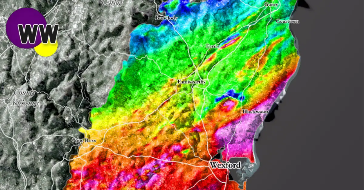
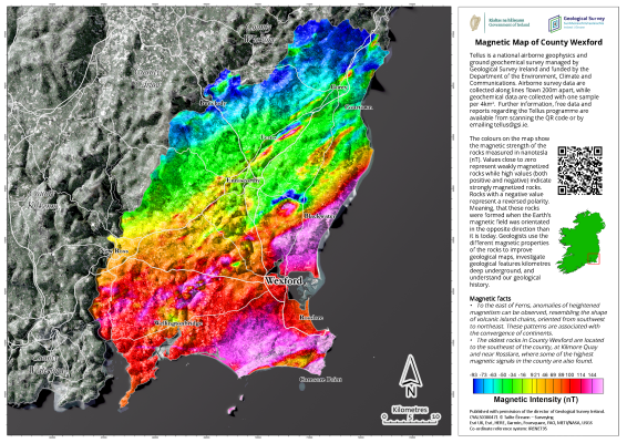
Geological Survey Ireland has today published three beautiful, geophysical maps of County Wexford, showcasing the country from a completely new perspective…
Since 2011, the Tellus programme of Geological Survey Ireland — a division of the Department of the Environment, Climate, and Communications — has been collecting geophysical data via onboard instruments on low-flying aircraft. The data, showing the magnetic, electromagnetic, and radiometric properties of the land, has now been compiled into a series of county maps with explanations on the information shown and key facts on the findings.

Koen Verbruggen, Director of Geological Survey Ireland, said:
“Geologists and geophysicists have a different way of looking at things, both in terms of time and space. They use colour to represent different properties of rock or millions of years in time.
“People may remember the aircraft flying low above their homes and might have wondered was there anything unusual found in their county. These maps are a chance to show the results in a form that’s accessible to all and to show people a different way to look at county Wexford.”
These maps showcase County Wexford’s ancient volcanic island chains as well as the direction of major faults. They reveal areas of saltwater intrusion as well as areas with bare rock and shallow soils. Additionally, the maps show the differences in soils whether they are derived from igneous and metamorphic rocks or derived from sedimentary rocks.
Airborne geophysics is a cost-effective means of detecting the physical properties of soil, rock, and water beneath the ground. The data can be used for various purposes, for example, geological mapping, mineral exploration, radon risk mapping, and geothermal energy exploration through the understanding of the subsurface. The Tellus programme started in Northern Ireland, and it is planned that surveys of the island of Ireland will be completed by 2026.
The Tellus maps of County Wexford are attached and also available, in higher resolution, here: https://www.gsi.ie/en-ie/programmes-and-projects/tellus/activities/tellus-county-maps/Pages/default.aspx.
Read also:
Remember to submit your news to Wexford Weekly! To advertise on our socials or website, email our team at info@wexfordweekly.com
