Looking for something to do around Enniscorthy? Looking for something to pass the time, or are you here in Wexford on a little trip?
Well, after our piece on the five best walks around Gorey, we decided to write another informative piece on the best walking trails around.
Here, we look at five of the best walks you could do around the Enniscorthy region.
5) Killoughram Forest
Killoughram forest near Caim in Enniscorthy is a lovely small native forest set in the gorgeous mid-Wexford countryside. The wood was once part of the huge Duffry Forest that extended from the Blackstairs to the Slaney.
Duffry translates to the Irish Dubh tire which means Black country such was the amount of darkness in the forest. Killoughram Wood played a vital role in the immediate aftermath of the Battle of Vinegar Hill as many rebels hid for the British authorities amongst the trees.
They became known as the babes in the wood.
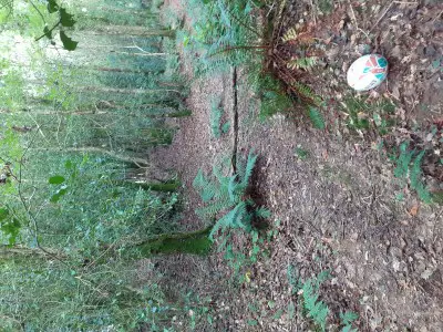
Today, the forest is a wonderful amenity for the area. When you park up, head straight onto the part and you quickly become immersed into what is a rare example in these parts of a totally native woodland comprising of Ancient oaks, ash and lovely Holly trees to name but a few species.
Continue on through the forest with its cute streamlet on your right-hand side.
The canopy is alive with bird species and there are many bird boxes to help them out. If you have the kids with you, wait for their excitement when they spot the gorgeous little troll doors and homes dotted near the path.
After 10 or 15 minutes, you’ll come to the end of the road at a farmer’s field which is beautiful in harvest time. You can explore this general area of the wood itself and then continue and take the main right to another pathway. After a few minutes, turn left and this track will take you back to the road and then down the slope to your car.
The walk should take 25 – 30 minutes.
The car park can be found on Google maps at 52.519730, -6.667996 near Caim village.
4) Oulart Hill
If you haven’t been here, then where have you been!?
Oulart Hill, steeped in the Military History of our massively fought over county, packs in much more. It includes a lovely walk and majestic views of the Sea, Wexford hills, and Mountains in the distance.
Park up at the Car park at the crest of the road where you can look at and read the information and designs on the stones and the information board itself.
This is the start of the walk beyond this barrier.
This section of the walkway is marked with the names of the various 1798 Wexford battles carved into stone, along with some other battles and the few rebels who died for Ireland here at the Battle of Oulart Hill.
On your right-hand side, from the start will be majestic views of the entire Blackstairs Mountain range, and as you trek along the path looking back, you’ll see Sliabh Bui, Carrigrua hill, Croghan Mountain and on a good day Wicklow’s Lugnaquilla Mountain.
This part of the walk is full of distractions while it also includes a gorgeous view of our Irish sea coast is to your left through the hedges. You will also come across an information board on your left with information on the Battle of Oulart Hill, including battle tactics and pictures of the insurgent surge down the hill.
This marks the exact spot where the Rebels plunged themselves into the North Cork militia and victory all those years ago. Next, you’ll come across the atmospheric modern Tulach an Solas (Mound of Light) monument.
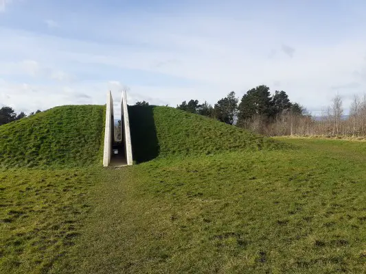
Passing straight through it, you can then head into the Forest which is a nice little walk through pines and other native tree’s, heading by Father Murphy’s well along the way.
You can turn back on yourself and walk back the same route to the car again, taking in the unreal views all around you.
Snacks for the walk can be found in the spar in the village and when you’re in the village, I’m sure the locals won’t mind if you bring the hurls, and have a puck on the central GAA pitch, home of many a past Wexford hurling legend.
Parking for the walk is found on Google maps by typing in Oulart hill car park.
3) The Slaney River Walk, Enniscorthy town
The Slaney river walk, starts on the Promenade, beside the Riverside park hotel in Enniscorthy town and takes you all the way to the Boro River confluence with the Slaney some three Kilometres due south of town.
The Slaney takes its name from the Irish Slaine, another way of saying health. Take this as a good omen; I’m sure that you’ll be in good spirits and health after this lovely riverside walk.
For me, there is nothing better than strolling by the water; there is just something so relaxing about its movement. If you get out here on a sunny day, I’m confident that you’ll feel ten times better.
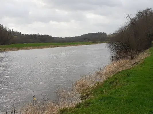
You should be able to see resident Swans on the river which are always a great sight, along with ducks and maybe even the cute Cootes.
In no time, you will have ascended the bridge at the River Urrin which is a tributary of the Slaney coming down from Mount Leinster. After this, the stoney path will take you into a wilder part of the walk and through a tranquil meadow teeming with wildlife and flora of the riverside.
These include Iris’, meadowsweet, and beautiful light yellow flower with a gorgeous aroma.
The entire route is situated next to the Slaney which forms a fantastic backdrop to your walk-in good company or on a solo run. The walkway, for now, stops shy of the Boro River.
Track back on yourself to the car after another memorable few minutes Slaneyside.
Parking can be found along the Promenade or Riverside park hotel Car Park, Enniscorthy.
2) Blackstairs Mountain
Standing at 734 metres above Blackstairs Mountain itself is great for a full afternoon’s trek.
The Mountain can be accessed via a Forest track at the end of Ballybaun lane, Grange, Rathnure.
Walk for approximately one mile until you hit a double hairpin bends in the trackway. Then, follow left at the first, take the right at the second, and then continue on straight.
This is an area of Sitka spruce and other evergreens but is still nice. After 600 odd metres, you’ll get to another hairpin with a rough track straight on with the Mountain towering above. Take that rough track straight on.
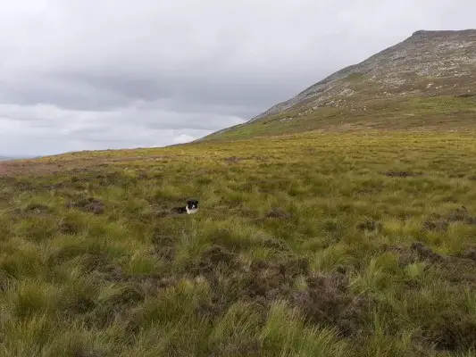
This area is known as Cooliagh Gap, Mam Ui Chulainn or simply the meetings.
People from Carlow and Wexford meet here on Mountain Sunday to enjoy, music, singing, dance, games and picking fraughan berries on the last Sunday in July, a tradition that has recently revived itself.
To make it easy for navigation use Google maps to find the border of the two counties exactly and then turn right.
Follow the county line all the way to the summit.
You’ll be cursing me to high heaven here because now your off-road and heading up one hell of a rocky slope.
Take it in short spurts and take a breather to look at the glorious views beginning to come into sight behind you.
Next, you’ll come onto a flattish part and you will come across the huge Rocky outcrop called Caher Roe’s den. Caher Roe was a Rapparee (Horse thief) in the Wexford area and it is said his treasure is buried in the den.
On your hike, you’ll spot lovely heather flowering in spring/summer, bog cotton, and possibly wild Orchids which are amazing. Animals and birds spotted are mountain hares, deer, stonechat, and red grouse.
It becomes difficult again for a while and then you take in the lovely summit with its mountain top marker cairn with Himalayan style bunting.
The views of the neighbouring areas of south Wexford and South Carlow and northwards to Mount Leinster is stunning from the pinnacle.
Return to the car the way you came, but thankfully it’s downhill this time.
Parking for the start of the hike is at Google maps 52.514543, -6.809724
1) Mount Leinster
Now we’re at the business end and the biggest Mountain in Wexford has been crowned with the number one spot.
But, I’m going to let you in on a little secret route that not too many know about.
This is the alternative Wexford only route of climbing Mount Leinster and it’s all off road and natural. This route starts in Clorougemore, near Kiltealy village.
You can park in a tiny spot at a hairpin bend at the start of the walk.
As per the locals, you can legally climb over the fence and start ascending Clorougemore hill or Tullawn (little hill) as it’s known locally using the old wall to your left as a guide. At the end of the wall, continue straight up the heart strewn hill until you come to a man-made cairn of stones called the piles locally.
You will notice a tumbledown house in the distance to your right, head over to it and then beyond to a standing stone pair.
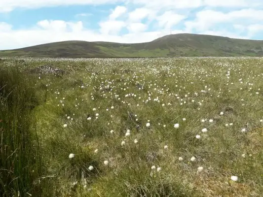
Trek to the edge of the forest at 52.592281, -6.754969, which is a good marker if you get lost.
Then make a b line over the beautiful Bog cotton filled bog land for Stoolyen which is the left hand or Southern shoulder of Mount Leinster on the Carlow border just under a mile from the forest.
Stoolyen is recognisable as it is like a lovely lunar landscape and it’s on the border.
Use google maps to travel straight to Mount Leinster along the border straight for the T.V. mast on the summit. The last 20 minutes is difficult, but the views South to Blackstairs Mountain is gorgeous.
Topping Mount Leinster look back to see South Leinster show itself off to you including the Barrow Valley and Wexford Harbour and the Southern section of the Blackstairs Mountain Range.
The summit Cairn is the burial place of the king of Leinster Cucorb of the Gaelic cycles.
Descend the mountain along the Border and whilst you’re in the area take in Knockroe hill or if you can’t take any more hardship, head for Clorougemore hill again and home via the Red Van.
Yes, it’s literally a Red Van in the middle of the bog!
Animals spotted on the Hike are sheep and a lot of them at that. Take your sheep selfie if needs be.
The flora is obviously similar too. This hike is a photographer’s dream with loads of opportunities to snap breath-taking scenes. Kiltealy shop is a good spot to grab yourself pre-hike snacks and water and the very, very detailed, handy and educational local map.
Parking for ascent is a Google maps 52.57919123, -6.747091
Please note: (especially for numbers 1 and 2 on this list):
Be nice to farmers if you come across them. f you have a dog, keep it on a lead at all times. There is a lot of sheep and wildlife around. Bring plenty of supplies in terms of food and water. Bring appropriate clothing/footwear. Bring a map and compass.
Be aware these hikes take a long time, in or around 4 hrs each and rugged uphill terrain so a morning start would be advisable. Make sure that you do it on a good day.
By Byron Jones
Read also:
Remember to submit your news to Wexford Weekly! To advertise on our socials or website, email our team at info@wexfordweekly.com


3 Replies to “Five Best Walks Around Enniscorthy You Should Try In 2022”